
Name of the M4 highway. Report on a trip along the M4 highway - a trip to the sea
The road from Orel to Dzhubga.
On Tuesday evening we decided to leave on Wednesday afternoon. We collected our things and food for the journey and went to bed.
Among the gadgets useful on the road, I had the following:
Car DVR, star X-61 radar detector (borrowed from a friend) and an Android with maps installed in it.
It’s better not to take a new radar detector on such a trip, in case it’s defective. I bought it from a friend who often and quickly travels to Moscow and back. He says no fines came. Of the maps I have Navitel and Yandex maps. I didn’t use Navitel because... I know the way, but Yandex maps came in handy near Voronezh.
We left at 13:30 and went straight to Rosneft. I filled up with 20 liters of AI-92. I didn't bother refueling anymore. It's enough to get to the M4, but gas stations there are a dime a dozen. We got to Liven quickly, the road was normal, there were a lot of “irons” this time, but we were in no hurry. The on-board computer showed me a consumption of 5.4 liters per 100 km, an average speed of 92 km/h. From Liven to the borders of Oryol and Lipetsk region The road is under repair, you can drive, but be careful. There are potholes on the side of the road. average speed on the Livny-border section 72 km/h. In the Lipetsk region the road surface is ideal. I was already in Yelets at 17-10. I was pleasantly surprised that we crossed the Yeletsky Bridge without traffic jams or difficulties. The bypass in Yelets was almost empty, but at every traffic light and overpass the radar beeped like crazy. At the toll section I already paid 60 rubles and now Voronezh is close. I drove onto the Voronezh bypass, drove across the bridge of the Voronezh River and got stuck in a traffic jam. Repair of the bridge to Borovoye. The length of the traffic jam according to Yandex maps is about 12 km. Locals and the Moscow region were all rushing to the dirt road. I didn't take any risks with my basin. Many tried to get around the traffic jam on the newly constructed road, but valiant traffic police inspectors were waiting for them at the exit. With a smile on their teeth and their staffs raised high, they rejoiced at their approach. I stood there for 2 hours, and it turned out that 2 trucks collided under the newly built junction and blocked the entire road. If it weren’t for the accident, I would have passed this section without any traffic jams. There is also construction going on at the exit from the district road. The markings there were worn out, so by intuition I drove out correctly and without any congestion. In Rogachevka we stopped to eat. Dinner time is around 9 pm. The cafe was chosen based on the number of truck drivers. The more truckers, the tastier and larger portions. Dinner for 4 persons cost 550 rubles. There I stopped at a Lukoil gas station and filled up my car for 600 rubles. Bodyaga AI-92 ECTO+. Onboard mileage is 480 km, fuel consumed is 29 liters. At first my “TazikV” refused to eat this ecological fuel. According to the principle “Give me some meat, fuck the greens for me.” It’s good that the on-board computer has the “Fast and Furious” function, which resets something in the brain and they reconfigure to the fuel that is in the tank. After using this function, the machine came to life and even became faster. In Rogachevka I met the StrelkaV device, which I was familiar with. Be very careful there, my radar detector beeped once and that was it. It’s good that I looked at StrelkaV from afar. I slowed down before the radar detector beeped. The road to Pavlovsk has 4 lanes. From Yelets to Pavlovsk I moved in the right lane, there were rarely potholes, and even then it’s hard to call them potholes after the Oryol roads. Afterwards the road became two-lane. The quality of the coating is mediocre, you can drive. At night it started to rain, the markings were barely visible, and in the oncoming lane “masters of life” in jeeps and expensive cars were making crazy overtakes. The headlights caught sight of cars that had left the road; one jeep was lying with its wheels up. I caught the “Iron” and held on to it. The truck turned out to be fast and moved at a speed of 80-90 km/h. Even if dirt flew from under it, I was calm about the oncoming traffic. They will not trample against overtaking trucks. And I kept my distance and drove to Mllerovo. There the road again turned into 4 lanes. There was a slight traffic jam in Tarasovsky, it was stronger there during the day, but we got through it at night. In Kamensk-Shakhtensky I stopped to drink coffee and replace the gasoline in the tank. This time I filled it with 92 without any nanotechnology additives. At 4:30 I passed Aksai. There are a lot of radars, be careful there. The post on the Golden Bridge was closed, the lights were turned off. Probably the traffic police were asleep or the post was actually closed, and I also didn’t meet any traffic police at the Bataisky post. There, carefully, I drive past the turn to Krasnodar for the second time. There is a ring and the turn is not very clear. In short, I cut an extra circle and moved on. There is a weight control point in Samara. The post was working, but the inspectors were busy with a truck that tore down the fence of the post. Oil and diesel fuel spilled all over the road. In Tsukerova Balka (Border of Rostov - Krasnodar region) strict post, I passed it at 6 am without problems and didn’t even slow down. Seeing my Basin from afar, they turned towards the Polish driver in an expensive foreign car. Next is the road to Krasnodar region Everything is under repair and there is no way to overtake along the entire route. At 8 am I drove up to Krasnodar. There, following the signs for Novorosiysk, I took the Dzhubga highway. There was another traffic jam on the Krasnodar-Adygea border for about 40 minutes. Road repair on platinum. I don’t recommend refueling in Adygea. There, in every garden there is a mini fuel production plant. Gas stations with the name Lukoil or Gazprime, RosTneft, are very doubtful. I got to Goryachiy Klyuch and at the very exit of the LUKOIL gas station, there is also a small hotel on 2 floors with parking. Usually here I sleep right in the car for about 40 minutes so that I can safely continue driving through the mountains. But I overcame sleep while approaching Krasnodar. Then my wife woke up and the road became more fun. I decided to carefully drive through the mountains without rest. Ahead lay only one dangerous section with a steep climb and a very steep descent of 3 km in length and turns of 120 degrees. 80 km to the sea. We arrived in Dzhubga at 10:30. There is a lot of tourist traffic in the village, so you have to be careful. Tourists break the rules and throw themselves under cars.
Mileage 1380 km, AI-92 fuel 68 liters, travel time (from home) 19 hours. We spent 3,000 rubles on the trip, including fuel, snacks and coffee. 85% of the road has 4 lanes, the rest is under repair or 2 lanes. Average speed is 80-90 km/hour. The last time I came to Dzhubga, the journey took 25 hours. The cost of AI-92 on the M4 highway is 28-29 rubles per liter.
The M4 Don highway consists of toll sections with different fares. All tariffs with prices are collected in this article and are relevant for today. The last reduction in prices for travel on toll sections of the Don highway occurred on October 1, 2018; in the future, the data will be kept up to date and changed in a timely manner.
In addition to the current tariffs, below are also visual maps of the sections of roads to which they apply. The information presented allows you to accurately determine the costs that will have to be included in total cost trips to the south if you are planning to go on vacation by car to Georgia, Crimea or to the resorts of the Krasnodar Territory, such as Sochi, Anapa and Gelendzhik.
Cost of travel on toll sections of the Don highway
The table below allows you to understand what price you will have to pay to travel a particular section of the road on a motorcycle, car or truck in different time days.
| Current tariffs in rubles | |||||||||
| Height (h) vehicle(TC) in m / number of axles |
Vehicles (h≤2 / 2 or more axles) with and without a trailer, as well as motorcycles with and without a trailer (sidecar) |
Freight and passenger vehicles (2 |
Freight and passenger vehicles (h>2.6 / 2) |
Freight and passenger vehicles (h>2.6 / 3 or more) | |||||
| Plot | Time | Cash | T-pass | Cash | T-pass | Cash | T-pass | Cash | T-pass |
| VFR 62 km |
07:00-00:00 | 60 | 42 | 90 | 63 | 120 | 96 | 240 | 192 |
| 00:00-07:00 | 35 | 24,5 | 50 | 35 | 70 | 56 | 140 | 112 | |
| VFR 71 km |
07:00-00:00 | 110 | 77 | 160 | 112 | 200 | 100 | 400 | 200 |
| 00:00-07:00 | 60 | 42 | 90 | 63 | 120 | 84 | 240 | 168 | |
| VFR 133 km |
07:00-00:00 | 160 | 112 | 230 | 161 | 300 | 240 | 480 | 384 |
| 00:00-07:00 | 110 | 77 | 150 | 105 | 200 | 160 | 300 | 240 | |
| VFR 228 km |
07:00-00:00 | 65 | 52 | 95 | 76 | 130 | 104 | 240 | 192 |
| 00:00-07:00 | 35 | 28 | 50 | 40 | 70 | 56 | 140 | 112 | |
| VFR 322 km |
07:00-00:00 | 65 | 52 | 95 | 76 | 130 | 104 | 240 | 192 |
| 00:00-07:00 | 35 | 28 | 50 | 40 | 70 | 56 | 140 | 112 | |
| VFR 339 km |
07:00-00:00 | 130 | 104 | 190 | 152 | 250 | 200 | 480 | 384 |
| 00:00-07:00 | 100 | 80 | 150 | 120 | 200 | 160 | 400 | 320 | |
| VFR 355 km |
07:00-00:00 | 45 | 36 | 75 | 60 | 90 | 72 | 180 | 144 |
| 00:00-07:00 | 30 | 24 | 35 | 28 | 60 | 48 | 110 | 88 | |
| VFR 380 km |
07:00-00:00 | 60 | 48 | 90 | 72 | 120 | 96 | 240 | 192 |
| 00:00-07:00 | 35 | 28 | 55 | 44 | 70 | 56 | 140 | 112 | |
| VFR 380 km |
07:00-00:00 | 90 | 72 | 130 | 104 | 170 | 136 | 340 | 272 |
| 00:00-07:00 | 55 | 44 | 85 | 68 | 110 | 88 | 220 | 176 | |
| VFR 401 km |
07:00-00:00 | 25 | 20 | 35 | 28 | 45 | 36 | 90 | 72 |
| 00:00-07:00 | 10 | 8 | 15 | 12 | 20 | 16 | 40 | 32 | |
| VFR 401 km |
07:00-00:00 | 110 | 88 | 160 | 128 | 210 | 168 | 420 | 336 |
| 00:00-07:00 | 80 | 64 | 120 | 96 | 160 | 128 | 320 | 256 | |
| PVP 416, 460 km |
07:00-00:00 | 90 | 72 | 130 | 104 | 180 | 144 | 350 | 280 |
| 00:00-07:00 | 60 | 48 | 90 | 72 | 120 | 96 | 160 | 128 | |
| VFR 515 km |
07:00-00:00 | 40 | 32 | 60 | 48 | 80 | 64 | 160 | 128 |
| 00:00-07:00 | 30 | 24 | 40 | 32 | 50 | 40 | 100 | 80 | |
| VFR 545 km |
07:00-00:00 | 50 | 40 | 70 | 56 | 100 | 50 | 160 | 80 |
| 00:00-07:00 | 30 | 24 | 45 | 36 | 60 | 48 | 90 | 72 | |
| VFR 545 km |
07:00-00:00 | 80 | 64 | 110 | 88 | 150 | 120 | 300 | 240 |
| 00:00-07:00 | 50 | 40 | 80 | 64 | 100 | 80 | 200 | 160 | |
| VFR 620 km |
07:00-00:00 | 70 | 56 | 100 | 80 | 150 | 120 | 300 | 240 |
| 00:00-07:00 | 50 | 40 | 70 | 56 | 100 | 80 | 200 | 160 | |
| VFR 1093 km |
07:00-00:00 | 50 | 40 | 75 | 60 | 100 | 80 | 200 | 160 |
| 00:00-07:00 | 30 | 24 | 45 | 36 | 60 | 48 | 120 | 96 | |
| Total | 07:00-00:00 | 910 | 701 | 1315 | 1013 | 1770 | 1326 | 3310 | 2480 |
| 00:00-07:00 | 590 | 455 | 860 | 664 | 1150 | 908 | 2090 | 1648 | |
| Saving | 07:00-00:00 | 0 | 209 | 0 | 302 | 0 | 444 | 0 | 830 |
| 00:00-07:00 | 0 | 135 | 0 | 196 | 0 | 242 | 0 | 442 | |
| The last change in fare was 10/01/2018. | |||||||||
![]()
M4 DON: toll sections on the highway
Below are detailed maps toll sections of the M4 Don highway ( orange color) with detour schemes for nearby free roads (green and gray).
Moscow region (21-93 km)
Good road surface, full night lighting, many lanes and gas stations round trip. The maximum speed limit is 130 km/h from 51 to 71 km and from 76 to 94 km, and 110 km/h from 21 to 51 km and from 71 to 76 km.
An alternative free section starts from the Moscow Ring Road and follows Kashirskoe Highway to the interchange at km 117, its length is 106 km - a detour of 10 km.

Moscow and Tula regions (93-211 km)
Alternative free route: Stupino - Kokino - Shemetevo - Gremyachee - Red Lakes, detour 45 km.

Detour to Bogoroditsk (225-260 km)
A section with excellent road surface due to the fact that many trucks go around it, trying to save money. Maximum speed is 120 km/h.
When you are given a receipt upon entering the checkpoint, keep it, because... at the end, upon departure, it will be necessary to present it to the controller.
Alternative route without payment: Krutoy Verkh - Bogoroditsk - Kuzovka, there is no difference in mileage.

Bypass the city of Efremov (287-321 km)
An alternative route runs through the settlements of Chernyatino and Pushkari, there is no difference in mileage.
The maximum permitted speed is 120 km/h.

Bypass of the city of Yelets and the village of Yarkino (330-414 km)
You should go around the Don highway through Babarykino - Yarkino - the village of Stanovoe - the city of Yelets - Ekaterinovka - the village of Timiryazev, there is no difference in distance.
The maximum speed is 120 km/h.

Bypass of the city of Zadonsk - the village of Khlevnoye (414-464 km)
Alternative route: Zadonsk - Khlevnoe - Kon-Kolodez.
Vehicles are allowed to travel at a speed of 110 km/h.

Bypass of Voronezh (492-517 km)
Those who want to save money will have to travel through Voronezh.
IN Voronezh region Drivers should be especially careful, because The largest number of video recording cameras are concentrated here and in some places the speed limit drops to 60, and the radar detector does not stop for 10 minutes. The speed limit requires vehicles to move at a speed of 110 km/h.

Bypass the villages of Novaya Usman and Rogachevka (517-544 km)
A detour to the toll section of the M-4 Don road runs through the villages of Aleksandrovka and Rogachevka.
Maximum design speed - 130 km/h, 4 lanes, opened 12/22/2016.

Voronezh region (544-633 km)
An alternative route passes through the settlements of Rogachevka - Brodovoye - Talovaya - Pavlovsk. Hook - 75 km.

Rostov region (1091-1119 km)
Bypass is provided through:
- Rostov-on-Don - exit to the village of Samarskoye - 1084th km of M4 via the Eastern Highway, Western Highway, along R-268, through the settlement Michurinets 3, Eremeevka, Samarskoye, with access to the Don highway at the 1103rd km .
- Rostov-on-Don - Novobataysk - from the 1084th km of M4 to highway R-269, through the villages of Kagalnitskaya, Ivanovo-Shamshevo, Novobataysk, with the exit to the Don highway at the 1103rd km.
Put into operation 05/19/2017 - 4 lanes, max. speed 110 km/h.

Krasnodar region
On this moment Travel through the territory of the Krasnodar Territory is free, but in the future it is planned to introduce payment for travel on the following sections:
- 633-715 km - start of construction of the bypass of the village. Losevo and Pavlovsk - May 2017, end - beginning summer season 2020.
- 777-847 km.
- 877-892 km - bypass Tarasovsky village.
- 948-1024 km.
- 1024-1091 - construction of the roundabout past Aksai began on 02/27/2018.
- 1119-1195 km - the deadline is 05/01/2019.
- 1195-1319 km - put into operation on 09/27/2018, they promise to start replenishment by May 1, 2019.
Detour toll road
You can bypass toll sections of the M4 Don highway if you really want to - this will save a certain amount of cash in your pocket, but will significantly increase the time spent behind the wheel. Submitted interactive map allows you to examine in detail alternative roads and the settlements through which they pass; to do this, simply click on the “plus” and “minus” on the left.
Map of all toll areas and their detours
The presented "paper" version has a high resolution with zoom and more current information.
Even if you don't mind the current cost of toll roads, detours can still come in handy. The fact is that in the summer, due to the ongoing repair of roads and their periodic narrowing, in some places there are traffic jams on the M4, stretching for tens of kilometers. In this case, there are 3 options:
- Stand in a traffic jam for several hours and breathe exhaust fumes.
- Trying to avoid traffic on the side of the road or driving into a ditch in a neighboring field.
- Turn off in advance and calmly drive along secondary roads.
Video
Two short videos about the M4 highway, telling about the organization of safety and the nuances of the speed limit, as well as the principle of operation of payment points with clear examples of payment in cash, a smart card and using a transponder.
The M-4 Don highway is the result of the work of the GIPRODORNII Institute, which is engaged in scientific design research in the field of road construction. The construction of the road was carried out in the second half of the last century (from 1959 to 1966).
The route was classified as a road of the 3rd technical category, with parameters of 7 m wide and two lanes. Initially, the M-4 Don highway was not designed for heavy traffic.
Starting from the 80s, the need arose to create an additional section of the road in the Moscow region (Domodedovo area), and therefore a section of 18.4 km was built. On the eve of the new millennium, the expansion of the route continued. In just one year (from 1999 to 2000), the M-4 Don became 135 km longer (including due to regional highways in Moscow and Tula), and the number of lanes increased to four to eight.
Important! As a result, today the route smoothly turns into Lipetskaya Street in Moscow. Such transformations of the M-4 Don made it possible to reduce the traffic load on the Kashirskoye Highway section of the road, which is now used mostly as a bypass route for cars from other regions of the country.
The route was also distinguished by the fact that one of its bypass sections in the Lipetsk region (near the village of Khlevnoye), built back in 1998, subsequently became the first in the country to charge a toll for travel along it. And although the length of this road was only 20 km, it became the first on the list of toll roads in Russia.
 Since the 2000s, large-scale construction aimed at developing the highway, creating roadways separated from each other, as well as intersections with other routes through the construction of multi-level highways, has continued to gain momentum. The night lighting system is being actively put into operation.
From 2009 to 2011, several bypass roads were built (the cities of Bogoroditsk, Efremov, Yelets, etc.), which made it possible to move heavy traffic outside settlements.
After control of the road passed to the state-owned company in 2010, it, together with partners (association of carriers, media) initiated a check of the condition of the route and the level of service on the road. As a result, it was found that half of the infrastructure did not meet the comfort requirements, and a third did not meet the legal standards. The history of the introduction of toll sections on the M-4 Don highway.
Reference! October 1999 - A Decree of the Government of the Russian Federation is issued regarding the establishment of the first toll section of the M-4 Don highway. The road surface itself and the infrastructure facilities around it were repaired: the road became wider and smoother, it was fully equipped with a lighting system at night; rest areas and express lanes began to comply with the provisions of the law.
A multi-level traffic interchange, which allows you to change to additional branches of the main road, was built at 461 km. A section of the bypass road between the settlements of Zadonsk and the village. Khlevnoye (from 417 to 464 km), which increased the total length of the route, became a toll road at the end of 2010.
 In the spring of 2013, a general Toll Point (TCP) appeared. They installed it at 71 km of the route for a section of 20 km (from 51 to 71 km). Subsequently, this segment became 52 km longer.
In 2013, sections of the road from 225 to 260 km gradually became tolled; from 330.8 to 414.7 km and from 287 to 321 km - a bypass route is being created around the city of Efremov.
2015 – new sections of the highway appear, for which drivers must pay. After a major overhaul of the bypass road around Voronezh, the section from 492 to 517 km became tolled. In the same year, all car owners began to pay for travel along the section of the route from 544 to 633 km.
2016 brought new changes. Now it was impossible to drive for free along 93-211 km of the Moscow-Tula road, and another 571-544 km in the Voronezh region (a bypass section of the highway was built here around the villages of Novaya Usman and Rogachevka).
In the Rostov region, tolls on the M-4 Don highway (from 1091 to 1119 km) were introduced at the end of 2017.
Attention! All toll sections of the route are equipped with special systems for collecting money for travel: open or mixed type. The vast majority of areas use an open system, which means that the driver pays once when passing through the toll point.
He no longer pays (regardless of the time frame) if he only moves without leaving the boundaries of the paid zone. And only on the Lipetsk section of the road (414-464 km) a different payment system is used: here drivers pay for travel when crossing the toll point, but the validity of the payment is limited to 12 hours. If the car stays within the boundaries of the toll zone for longer, then the fee is paid again when leaving the territory. The length of stay in a paid area is determined on the basis of a check issued to the driver upon entry.
 For convenience and safety of traffic, all toll sections are equipped with landline telephone facilities, through which, in the event of an emergency, you can contact emergency services.
On toll roads there is no traffic light system or adjacent side roads, and oncoming traffic flows are separated from each other. This allows drivers to reach speeds of up to 130 km/h.
They are equipped with toll roads and an automatic control system, the functioning of which is ensured by the work of various technical equipment. means - video cameras, weather stations, etc. This allows you to quickly receive information about the situation on the road depending on the weather, lighting, and emergency situations.
Reference! The collected data makes it possible to quickly make decisions to eliminate any problems on the highway, with the involvement of the appropriate assistance services. Information important for ensuring normal traffic flow is posted for drivers on the road special. scoreboard
The establishment of tolls is under the jurisdiction of the Government of the Russian Federation, which acts on the basis of Article 36 of the Federal Law of November 8, 2007 N257-FZ.
(function(w, d, n, s, t) ( w[n] = w[n] || ; w[n].push(function() ( Ya.Context.AdvManager.render(( blockId: "R-A -142249-1", renderTo: "yandex_rtb_R-A-142249-1", async: true )); )); t = d.getElementsByTagName("script"); s = d.createElement("script"); s .type = "text/javascript"; s.src = "//an.yandex.ru/system/context.js"; s.async = true; t.parentNode.insertBefore(s, t); ))(this , this.document, "yandexContextAsyncCallbacks");
Usually people are in a hurry somewhere along the highways and don’t really stop. Is it just to refuel the car, have a snack, buy water or something else vital...
What if you're not in a hurry? Or hurry, but not too much?..

Highway M4-Don in the Rostov region, 781st kilometer
So, let’s imagine that you are driving along the M4-Don highway... well, let’s say, from Moscow to Novorossiysk. And you have some time. And now you are entering the Rostov region. And you want to not only drive it from end to end (by the way, several hundred kilometers, to be precise, 342 kilometers), but also see something interesting...

Highway M4-Don in the Rostov region, 837th kilometer
The route leads to the Rostov region from the Voronezh region (the last relatively large settlement among its neighbors is the village of Verkhniy Mamon).

Verkhniy Mamon is also the Voronezh region, also the Dyadin farmstead - and we are in the Rostov region
In the Rostov region, the Don highway follows the following route: Millerovo (leaving this city to the west of the highway), Kamensk-Shakhtinsky (driving through it along the edge), Krasny Sulin (leaving it to the west), Shakhty (leaving them to the east), through Aksai, past Rostov -on-Don along the bypass road, across the bridge over the Don River, and goes south, past Bataysk and the village of Samarskoye (leaving them to the west) to the Krasnodar Territory.

M4-Don highway, legend in the Wikipedia version. We have more details :)
Interesting fact: Do you know that in the Rostov region, the city of Rostov-on-Don, the border between Europe and Asia runs along the Don River? Rostov-on-Don is located in Europe. And Bataysk is in Asia. Thus, according to federal highway Don you can come from Europe to Asia.
The magic of numbers and distances
Steppes, steppes, steppes... Somewhere on the Internet I came across an opinion that the most boring section of the entire M4-Don highway is the Rostov region. Don't believe such statements!
Yes, our landscapes are somewhat monotonous (although after traveling through Kalmykia, I am no longer so sure of this). Of course, you won’t see any mountains, seas, or rocks from the route. But you will see waste heaps, hills, rivers, small forest belts, and in the summer - cheerful fields of sunflowers...

Sunflower fields along the highway
And if you pay a little attention to the M4-Don highway in the Rostov region, it will become much more interesting...
When entering our region from the north side, I always think about the magic of numbers. The Rostov region begins at the 777th kilometer from Moscow.
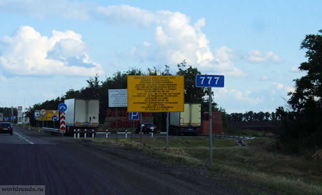
777th kilometer - the Rostov region begins here
Three lucky numbers (by the way, right there, on the 777th km of the highway, there is a Lukoil gas station).

And if you also remember that the license plate of the region is 61 (in numerology it would be 6+1), then in the end it’s the same seven. This explains a lot, doesn't it? The route in the Rostov region is the happiest! I'm kidding, of course. But, as you know, in every joke...

Sign on the border of the Rostov region
The M4-Don highway, passing through the Rostov region, crosses 8 districts: Chertkovsky, Millerovsky, Tarasovsky, Kamensky, Krasnosulinsky, Oktyabrsky, Aksaisky and Azovsky. And in almost every one of them, not far from the highway, and sometimes on it itself, there is something interesting.
Here we go? And you decide for yourself where to turn, where to stop and where not...
Chertkovsky district
And we will start in order, as we are going, from the north of the region. The Don highway begins in the Rostov region in the Chertkovsky district (of course, if you come from Moscow).

And immediately after the Voronezh region we cross the border line between the regions and find ourselves in the Chertkovsky district.

Chertkovsky district
It’s probably not for nothing that it’s called that: there’s an invisible line between the lands here. In the north of the region - with the Voronezh region, in the west - with Ukraine. But seriously, the area bears the name of military ataman Mikhail Ivanovich Chertkov.

If immediately after entering the Rostov region you leave the highway to the left (just after the 778th kilometer, photo of which is above), towards the village of Kazanskaya (65 kilometers from here), then there is a lot of interesting things there.

Interchange on Kazanskaya
For example, the underground monastery of the village of Migulinskaya (Verkhnedonskaya region). But this is a bit far for those who are just driving along the highway and do not intend to spend several days in our region.
The 779th kilometer is a rest stop near the village of Nagibina, Chertkovsky district. Here you can gain strength before exploring the large and interesting Rostov region.
801st kilometer. Here: traffic police, turn to Chertkovo, cafe, roadside motel.

Interchange on Chertkovo
District center – Chertkovo village. Turn right onto it after the 801st kilometer. And then another 30 kilometers to the village itself.
What is remarkable about this village? It has Friendship of Peoples Street, along which the border between Russia and Ukraine runs. Yes, yes, the houses on one side of the street are on Russian territory, and on the other are Ukrainian. A street with the same name, but already in the village of Melovoe, Lugansk region. Can you imagine how many times a day you can go abroad?
But if jokes of this kind do not interest you, then in the Chertkovsky district there are other sights, significant and historical.

M4-Don highway in Chertkovsky district
For example, the square from “Quiet Don” in the village of Mankovo-Kalitvenskoye. It was to this square that Grigory Melekhov arrived for military training. And to this day, the Maidan in front of the church, where the Cossack circle gathered, has been preserved here.
Also in this village, on Sovetskaya Street, you can see the grave of the writer Yevgeny Petrov, Ilya Ilf’s co-author of “The Twelve Chairs” and “The Golden Calf”.
If you have time, keep in mind that there are also natural attractions here. The most important of them is the Zhuravsky reserve, spread over 12 thousand hectares.
Millerovsky district and Tarasovsky district
Here is the Millerovsky district. It is located in the north-west of the region, and borders Ukraine for 70 kilometers.

At the 854th kilometer there is a Bashneft gas station.
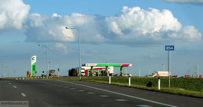
Bashneft gas station at the 854th kilometer
The entire section of the highway in the Rostov region is landscaped. Bus stops illuminated at night by lanterns on solar powered. There are toilets near the stops.

At the 855th kilometer there is an interchange to the village of Veshenskaya. There - state museum-reserve M. A. Sholokhova. From the interchange to Veshenskaya - 142 kilometers, to the Sholokhov Museum - 144 kilometers. The museum is located in the Sholokhov district, in the village of Veshenskaya at the address: Sholokhov Street, 103. But the Sholokhov Museum-Reserve is a separate issue.

Interchange on Veshenskaya
860th kilometer – interchange at Millerovo. It is only 4 kilometers from the highway. The town of Millerovo itself is small and industrial. It is notable for the fact that it is the northernmost city of the Rostov region, and indeed the entire Southern Federal District. It stands on the Glubokaya River. Bears the name of the Russian German Ivan Miller. In our case, Millerovo is also notable for the fact that it is located exactly in the middle of the route along the M4 highway (if you take it all, and not just the section in the Rostov region).
In addition to places associated with the name of the great writer Sholokhov, there are other attractions in the Millerovsky district. For example, Voloshinskaya mountain – favorite place training of local hang gliders. It is located near the village of Voloshino.
There are still some in Millerovo district Fominsky Reserve, on the territory of which there are 176 mounds (23 of them are archaeological monuments).
After the 878th kilometer comes the Tarasovsky district.

Previously, there were huge traffic jams in front of Tarasovka, and you could get stuck here for a long time. Now they have made a bypass road, and this section of the road has become comfortable for drivers.

39 kilometers to Tarasovsky
It seems that about the Tarasovsky district is all I can tell. To be honest, I don’t know the areas in the north of the region well yet. But it’s clear that there are no attractions right next to the highway.

11 kilometers to Tarasovsky
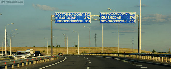
There are still 202 kilometers to Rostov-on-Don
Well, how do you like the beginning of the M4-Don highway in the Rostov region?
And a big request to everyone who knows these regions well - write your additions in the comments! Maybe I forgot something or overlooked something along the way...
All materials on the “Roads of the World” website are copyrighted. We kindly ask you not to take articles and photographs without permission from the author and the site administration.
© Galina Shefer, “Roads of the World” website, 2014. Copying text and photos is prohibited. All rights reserved.
——————-
Related posts:
(function(w, d, n, s, t) ( w[n] = w[n] || ; w[n].push(function() ( Ya.Context.AdvManager.render(( blockId: "R-A -142249-2", renderTo: "yandex_rtb_R-A-142249-2", async: true )); )); t = d.getElementsByTagName("script"); s = d.createElement("script"); s .type = "text/javascript"; s.src = "//an.yandex.ru/system/context.js"; s.async = true; t.parentNode.insertBefore(s, t); ))(this , this.document, "yandexContextAsyncCallbacks");Even those citizens who have never traveled outside of Russia have heard that abroad you have to fork out money for travel on roads, as well as for using bridges and tunnels. Now, in our modernized Russia, efficient businessmen have begun to charge money for road travel. A striking example of this is the M4 (“Don”) highway. Paid sections appeared on it in 1998. Now there are over 530 km of them on this road, and in the near future there will be almost twice as many. In addition to payment, how do these sites differ from alternative free sites? Is there any benefit to using them? How can drivers who do not want to shell out their hard-earned money get to their destination without paying anything? Let's figure it out.
Historical reference
The route, which is now causing so much controversy, leads from Moscow to Novorossiysk through such big cities, like Krasnodar. Its length is 1543.7 km. Part of this route from Moscow to Rostov-on-Don was once called Route No. 5 and was built in the late sixties of the last century. During this period, the road was two-lane, with a width of only 7 meters. During the years of perestroika, the construction of its backup began, on which traffic lights were not installed, that is, they tried to make it a high-speed one. In 1990, 18.4 km were put into operation, including two sections in the Domodedovo area. Until 2000, the development of the M4 highway actively continued, as a result of which the road became 500 km longer and stretched to Dzhugba, plus it included a piece of the Sukhumi highway to Novorossiysk, and 135 km of backup sections with up to 8 lanes appeared. They were built in Moscow and Tula regions with funds from the state budget. At that time, no money was charged for traveling on the M4.
Paid areas
As a result of construction and road manipulations, the M4 highway has significantly increased its capacity and become more convenient. Paid sections began to appear on it in 1998. The first was only 20 km long and went around the village of Khlevnoye. This part of the road was opened with pathos, as it became the first toll road in all of Russia. reconstruction with the construction of bypass sections was carried out with enviable activity. The result was two toll sections at once:
1. At 225.6-260 kilometers (35 km detour of the city of Bogoroditsk). Now from the Moscow Ring Road to it, almost the entire section of the highway is tolled (with the exception of a small piece 14 km long from the intersection of the M4 with the road to Uzlovaya to the intersection with the road to the village of Chernaya Gryaz).
2. At 287.8-321.3 kilometers (34 km long detour to the town of Efremov).
Now drivers of cars pay here from 35 rubles, depending on the time of day and class of car, and drivers of trucks - from 240 rubles.

Avtodor innovations
In 2010, the Avtodor company became the manager of the Don highway, which has a very positive attitude towards tolls for drivers.
The company's specialists first analyzed the condition of the road and began repairing it, simultaneously building new bypass routes. The result is a higher quality, but also more M4. Since 2010, toll sections have appeared on the following kilometers:
330.8-414.7 (bypass the village of Yarkino and the city of Yelets).
416.9-464 (bypass of Zadonsk).
Several toll sections with a total length of 141 km were built to bypass the glorious city of Voronezh. They start at 492 km and end at 633 km, going around Voronezh, Novaya Usman and Rogachevka. The free inserts here are very short, so the three payment points are installed almost one after the other.
paid areas (2016)
The Avtodor company is going to continue to shorten sections of the route on the Don highway that can be ridden for nothing. Thus, in 2016, two new sections with a total length of 190 km became toll roads. The first one starts at 21 km (just outside the Moscow Ring Road) and lasts 72 km. The second one starts from this road marker and lasts another 118 km. You have to pay for crossing the barrier twice, the first time - from 50 to 140 rubles, the second time - from 80 to 450 rubles. In total, Avtodor plans to make 892 km toll roads by 2020. Now their length is 531 km. Some drivers are interested in what Avtodor employees will do if they drive up to a toll booth and say that money was accidentally forgotten at home. The answer will not please you - such drivers will be forced to go back, but no one will raise the treasured barrier for them.

How many toll sections are there on the M4 (Don) highway?
2 in Moskovskaya;
2 in Tula;
2 in Lipetsk;
3 in Voronezhskaya.
In addition, 5 paid exits to the highway are open in the Lipetsk region.
In general, you will now have to pay for travel from Moscow to Rostov-on-Don for a passenger car from 510 rubles, and for trucks - from 2660 rubles one way, but it is quite possible that prices will change.

Road quality
Along with the question of how many toll sections are on the M4 highway, drivers are also interested in the question of what they have to pay for. From the Moscow Ring Road to the exit to the village of Vidnoye there are 8 lanes on the road. Further, to Saratov - 6 lanes, and after - 4 lanes. According to drivers, the quality of the road surface is good, but the speed limit on toll sections is no more than 110 km/h. There are unequipped toilets, gas stations, and cafes along the route. In addition, there are points where you can call a tow truck, a gas station or a repair team. The downside of toll roads (besides the price) is the queues at payment points, and the transponder does not always help, since there is no perfect system for its use yet.
The free road has mostly 4-5 lanes (3 or 2 in one direction, 2 in the other), in some sections there are only 2 (one each to the south and to the north). The quality of the road surface along its entire length is satisfactory, because road services are also involved in repair work here. Along the road, as on the toll M4, there are cafes, gas stations, and unequipped toilets. You can drive along this highway at a speed of 90 km/h. Large trucks, of which there are plenty here, create inconvenience. On average, the time lost when driving around a toll road is about half an hour.

How to get from MKAD to Kashira
Let us remind you that the M4 highway originates from the point where the Moscow Ring Road intersects with Lipetskaya Street. Toll sections are open from the 21st km, but so far Avtodor has blocked the road with barriers and installed the first toll point only at the 62nd km. Therefore, from the Moscow Ring Road to the intersection with A107 (this is the 51st km of the M4 highway) you can travel for nothing. Also, exits in the direction of Vidnoye (on the 22nd and 24th kilometers), exits in the direction of Domodedovo (this is on the 31st, then on the 34th and 46th kilometers) and the exit on the A107 are not yet paid. For those who travel further, from the Moscow Ring Road you can travel for free along the Kashirskoye Highway to the settlement of Sitne-Shchelkanovo. Next, at a fork, the road will go towards Stupino. Here, at the intersection in front of the railway, you need to turn onto Pobeda Avenue, follow it back to Kashirskoye Highway and follow to your final destination. The disadvantage of this route is that the Kashirskoye Highway is quite heavily loaded and, as a result, there are frequent traffic jams. This road is currently being reconstructed, so if it is left free, it will be a good option.

How to get around the toll M4, heading to Bogoroditsk and Efremov
There are several options for bypassing toll sections on the M4 highway. So, if you are traveling to Bogoroditsk and beyond, you can use the driving directions indicated above. This means you need to drive along the Kashirskoe highway to Stupino, then turn onto Pobedy Avenue, return without stopping at Kashira, follow to the fork in front of the village of Zendikovo, turn there onto the Voronezhskoe highway, or continue along Kashirskoye to the P22 highway, which leads further and further from the M4 . In the Venev area this distance is approximately 30 km. To get to Bogoroditsk by this route, you will have to wind your way along country roads, the quality of which is far from satisfactory, and in addition, you will have to “wind up” extra kilometers.
Some drivers advise driving to Bogoroditsk and nearby settlements for free along the Simferopol highway (M2). The condition of the road surface here is excellent, the speed can be reached up to 90 km/h. Beyond Tula you need to turn onto the road leading to Bolokhovo and follow it to Black Mud. There will be an exit to the free section of the M4. The difference will be several kilometers. Those who need to go to Efremov can, following the same M2, pass Tula, Shchekino without stopping and turn right at the intersection in the village of Lukino. From there, an almost straight road will lead to Efremov.

How to get around the M4 heading to Voronezh
The shortest distance from the capital to Voronezh is 516 km. On this long journey it is difficult to avoid every toll road section. The M4 highway from the Moscow Ring Road to Voronezh runs past Bogoroditsk and Efremov. Above we described how you can get to these settlements for free. Despite some differences in mileage, many drivers choose the Simferopol Highway, which is quite pleasant to travel along. The number of lanes on this section varies between 2 and 4, the road surface is in good condition, and there are many gas stations and cafes along the route. Follow it further to the village. Lukino is unwise, since to return to the M4 you will have to make a significant detour. If you follow this route to the 321st km (the end of the Efremov bypass road, the difference in mileage will be only about 7 km (approximately 307 km along the M2 and about 300 km along the M4). Then you can drive 9 km along the free section of the Don highway ". Having reached the exit to the toll road, do not turn onto it, but continue moving along the railway track, past Yarkino, cross the Sukhoi Kolodets stream, the railway track, go around Yelets along its outskirts, the Bystraya Sosna river, get closer again from the M4, drive through Zadonsk, Khlevnoe, the free section of the M4 and, without entering the toll section, turn onto the road to Voronezh. The difference in mileage along this route is very small, but the road surface is much worse than on the toll highway. The second inconvenience is traffic jams in Zadonsk and loss of time traveling through Khlevnoye and Voronezh.
How to get around the M4 heading to Rostov
The bypass of toll sections on the M4 (Don) highway ends in the Voronezh region, at the 633rd kilometer. Further south you can go calmly. A new site is currently being designed toll road bypassing the city of Pavlovsk, but so far it is not there. To get onto the free M4 from Voronezh, you need to pass 3 more toll sections. Two of them - through Novaya Usman and Rogachevka - can be passed without difficulty. As a result, the last 89 km remain. It will not be possible to get around them with minor losses. If you turn left onto P298 after Rogachevka, you will have to make a big detour. There are no convenient right turns here. Therefore, the detour must begin from Voronezh. There are two options here - left along highway 193 or right in the direction of the village of Liski. Both of these options are inconvenient due to a lot of extra mileage and poor quality roads.